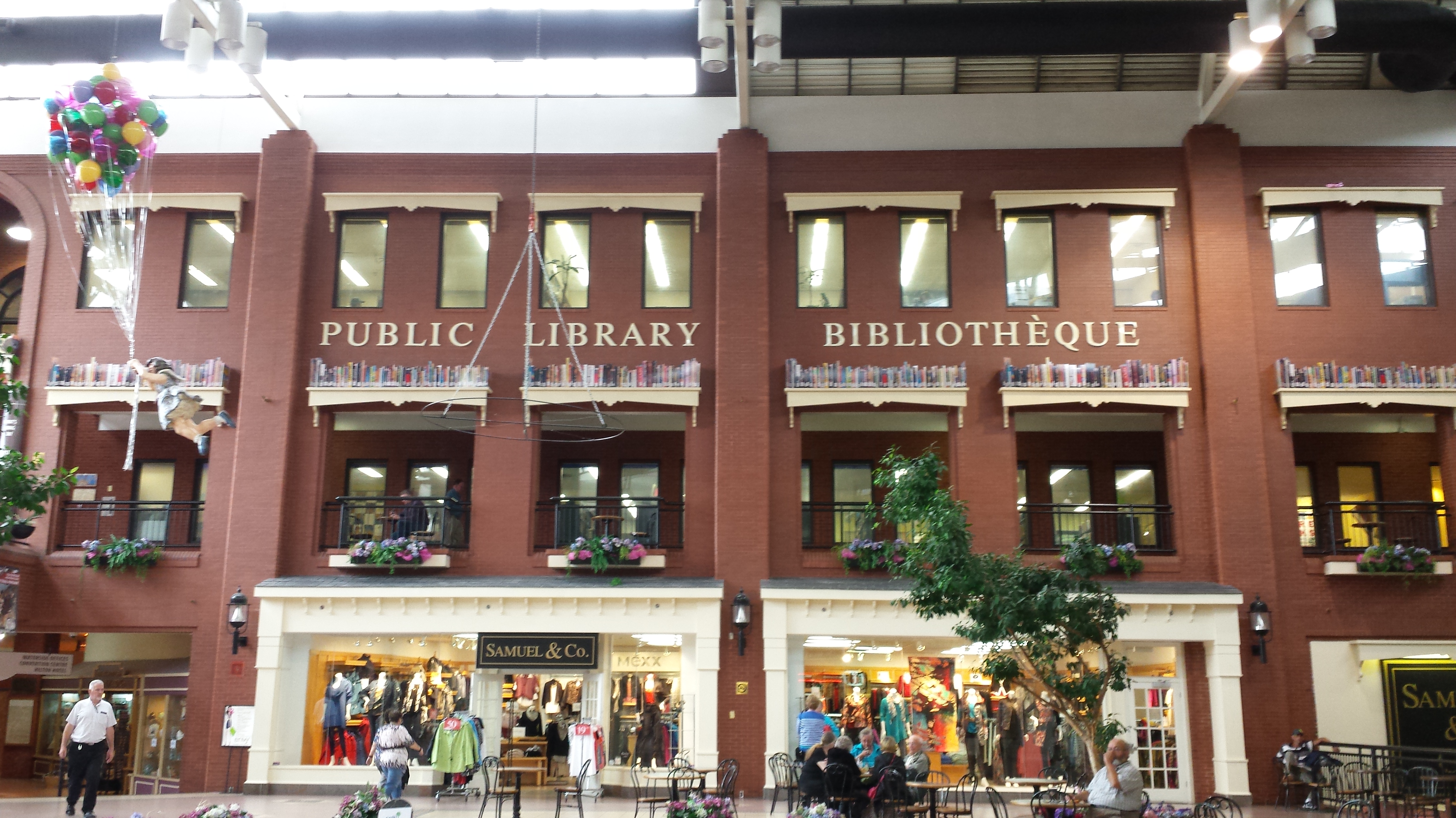
We are here after tourist season has ended, and the guided walking tours of the city and the amazing geological settings are no more, so the 2oldhippies take the self-guided tour books in hand and explore downtown Saint John and the harbor front. There is a lovely little city market, one of the oldest in continuous operation in Canada, just off Kings Square in downtown. City Market is one terminus of an indoor network of walkways (much like “underground Montreal”) that lead from the center of downtown to the harborfront hotels, the New Brunwick Museum and the Saint John Public Library, which are the anchors in a shopping/commerce/office complex overlooking the river. (Note the books lined up on the second floor “shelf” under the windows.)
We ask if it really does get that cold here in winter and are told that yes, it does snow here. Somehow, the idea of “snow” and the ocean doesn’t compute for us landlocked northern tier people.
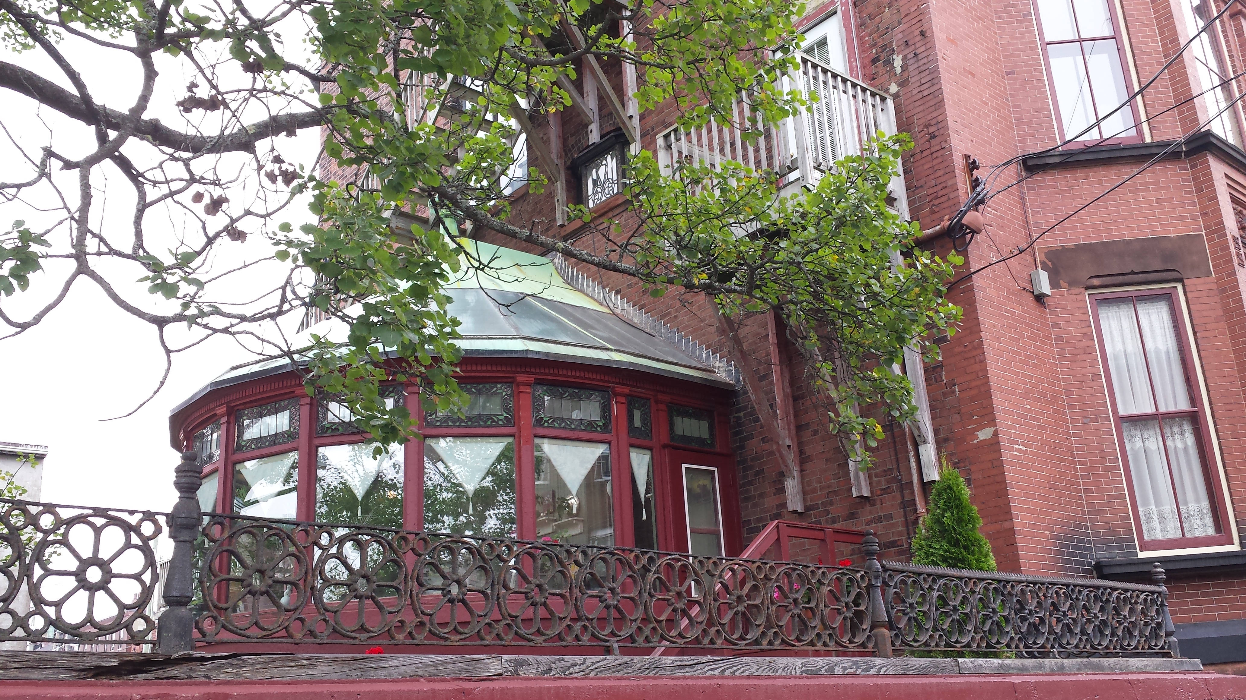
Throughout the city are informational billboards describing the history, architecture and geological features of the city, all of which are legion. Saint John was once the third biggest producer of sailing ships, was where almost all of the lumber from New Brunwick was put on ships for Old and New England. Three-quarters of the city burned in 1877 (the photos look like San Francisco after the earthquake), and for the rebuilding the city imposed strict codes and requirements to assure harmonious, efficient and safe development. (Oh, Canada!) The result is a harmonious efficient and safe little city by the Bay of Fundy. The major commercial buildings took advantage of the remarkable variety of stone available for facades, columns, porticos and other lovely details.
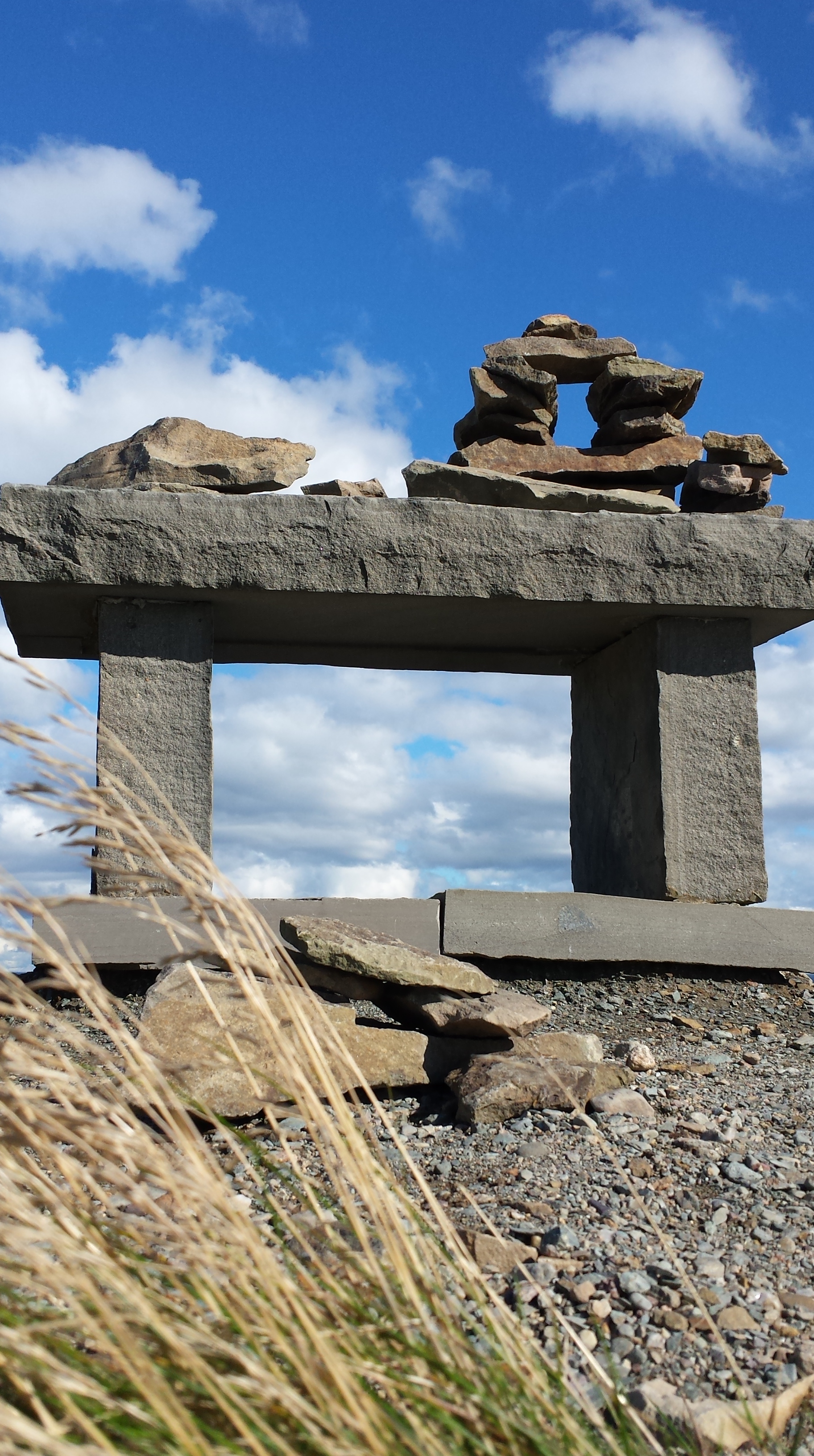
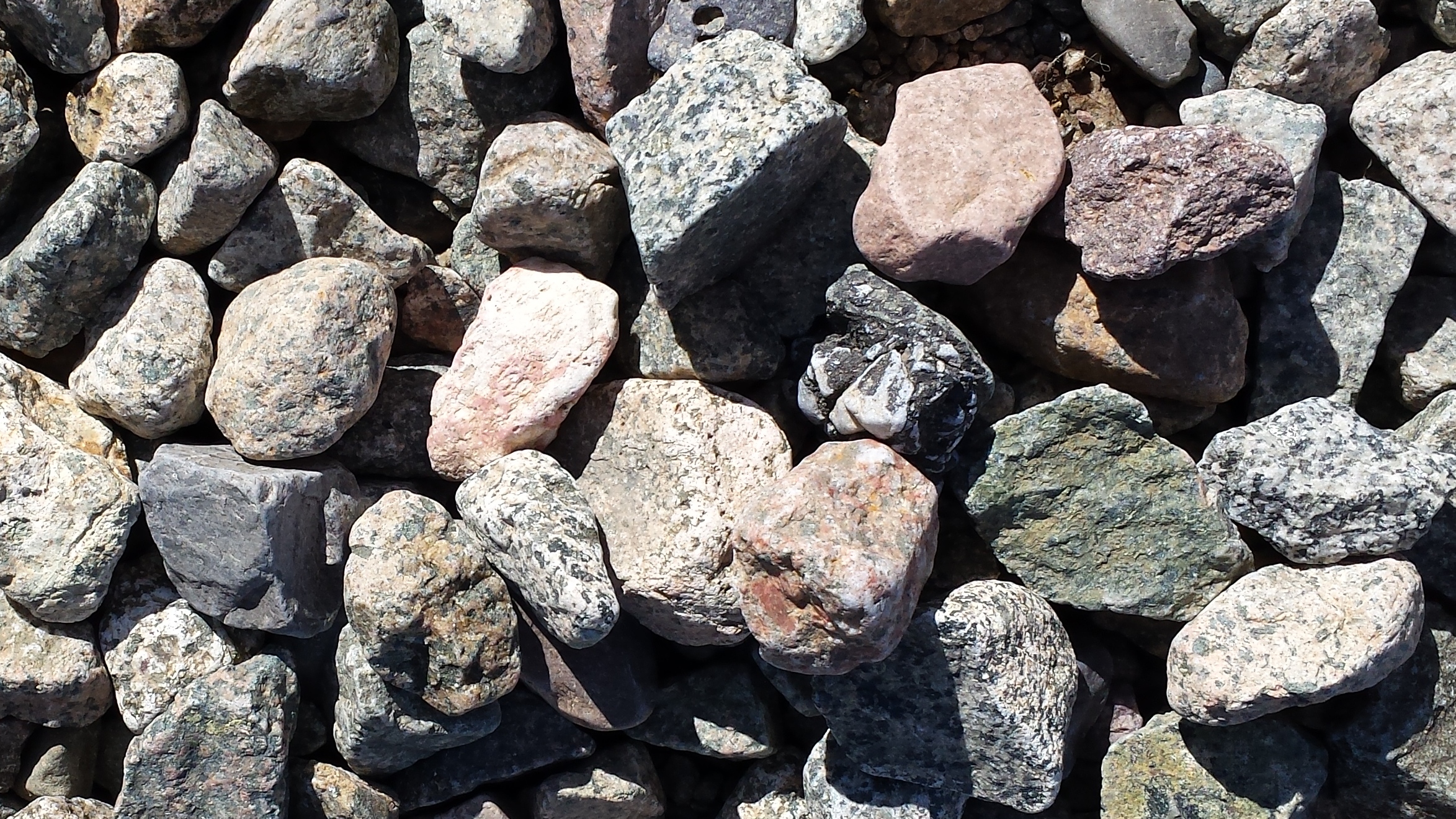
Geologically — I send you to www.stonehammergeoparc.com, the website that drew me to this location to begin with. While Fundy is famous for the highest tides in the world, tides so high that the waterfalls in Saint John reverse and go upstream twice a day, it’s also now celebrated as a unique geological site on Earth. Solid evidence here (pun intended) displays the very origins of our continents and seas, and the forces of plate techtonics “from the origins of seaflow spreading, to the colliding of continents, and the subduction of plates.” And if that description doesn’t excite you, how about this? The Stonehammer Geopark encompasses sites dominated by rocks dating from the Pre-Cambrian right up to the Quaternary, and stone formations that link these sitea to places in South America and Africa. It’s a techtonic wonderland. We attend a reception at the New Brunwick Museum for the world Geoparc Conference kicking off this week, bringing over 400 geologists, anthropologists, rock heads and rock hounds from dozens of countries to this site, with their little stone hammers. I can’t stop taking photos of the geomarvels that abound. Formations from a mere 100 million years ago, shoved up against, or thrust above, or driven below formations from 700 millions ago.
Simply put, we find rocks side by side that have no business being together on the same beach.
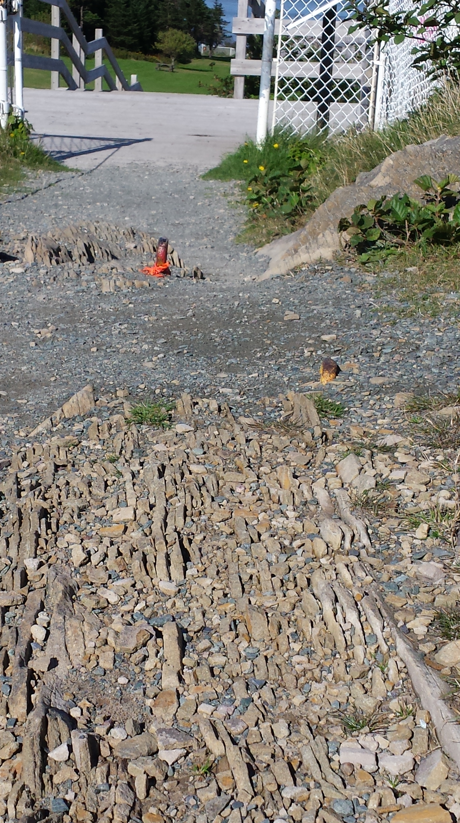
We find edges of sedimentary layers fragmenting as they are exposed to the elements — 90 degrees off kilter, pointing straight up instead of laying sideways.
 I supposed you don’t have to love rocks to enjoy coastal New Brunswick and the Bay of Fundy, but apparently, 2oldhippies aren’t alone in our fascination.