A short drive north of Saint John is St. Martins. Look at a map of the NB coast and you’d think only Anglicans and Roman Catholics settled this area for all the saints memorialized here. And while I’m on the saint thing: inquiring minds want to know why Saint John is always presented with “Saint” spelled out, but St. Martins, St. George and St. Stephen use the abbreviation. And while we are at it, why is St. Martins plural or did they forget the apostrophe? I’m sure there are stories behind all this; there usually are. I just forgot to ask.
 St Martins is formerly a sleepy fishing village and now a sleepy (in the off season) village of inns , B&Bs, and campgrounds, along with lovely beaches, spectacular sea caves, and the crazy tide lands. It sits on a small bay of the great Bay, between some striking headlands, and is the gateway to the Fundy Trail, a relatively new provincially developed parkway, bike and hiking route that eventually will connect Saint Martins to Fundy National Park. We try to bike the parkway bikepaths, but they are for youngerhippies or oldhippies with better knees. Steep up and downs hugging the coastline; great for those we think of as “mountain bikers”, so the 2oldhippies Westy ourselves around and hike instead. Everywhere extraordinary coastline views and,oh yeah, more rock love – a lot more.
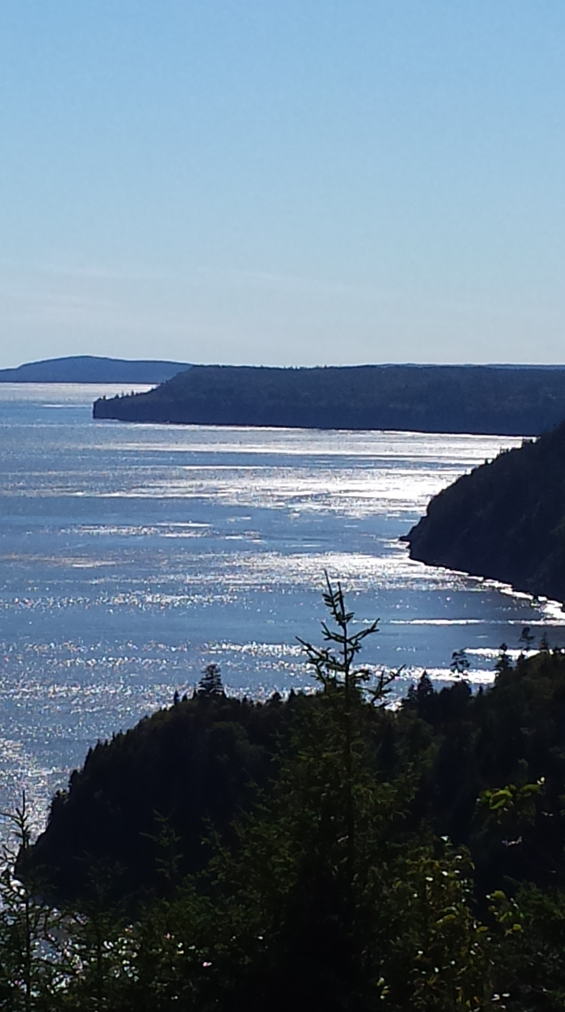
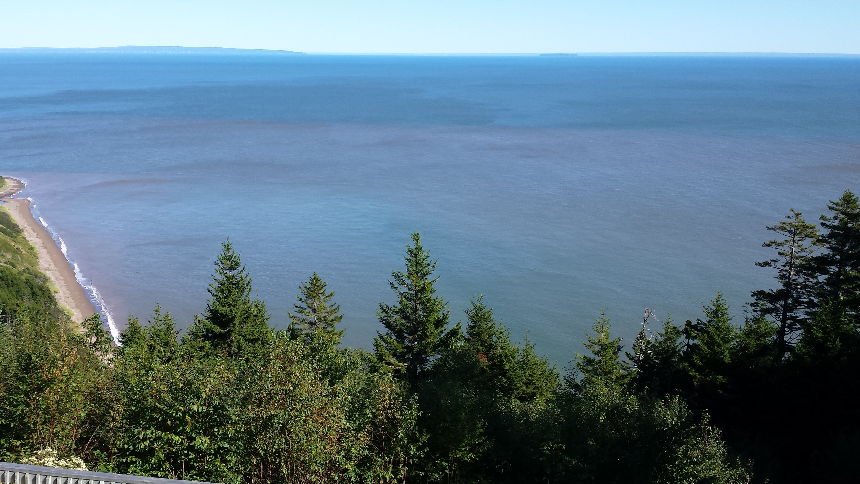
The coastal views are similar to Mt. Desert/Acadia, except that there are a lot fewer people, huge tide flats twice a day, few sandy beaches, and it’s hard to find a motel or gift shop anywhere.
When the tide goes out, it goes out to where the color of this water changes. Yeah, that far out.
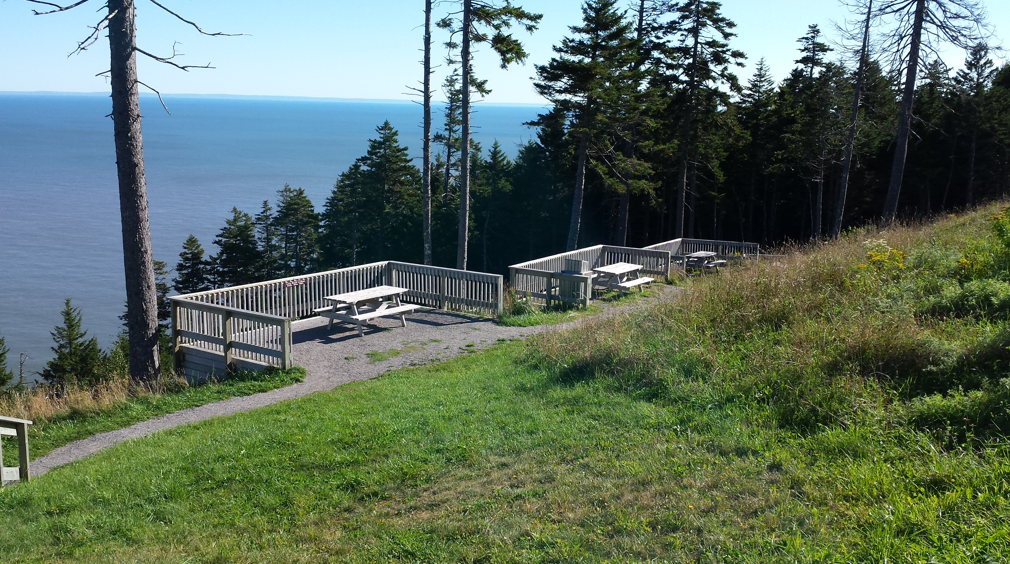
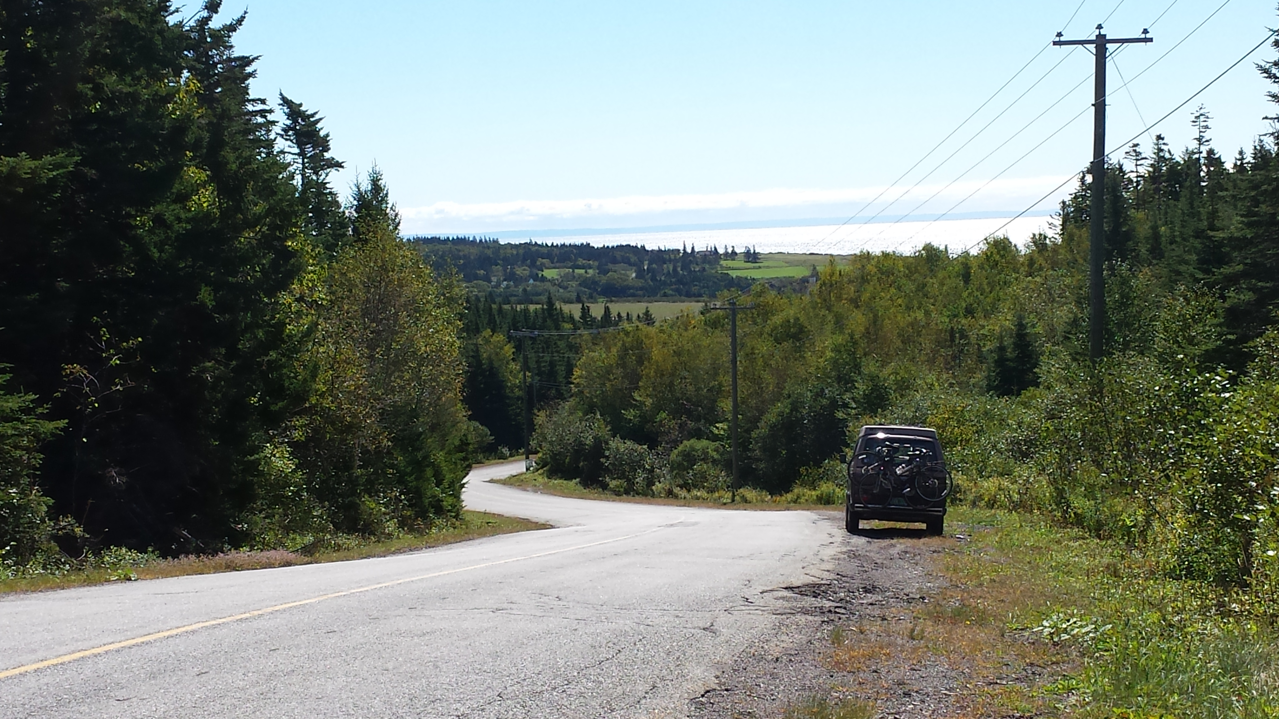
The Fundy Trail astonished us at the scale and scope of this public investment in a roadway, bike and hiking path network that is not a through route to anywhere, and whose only purpose is recreation and sightseeing. At one of the great view-sheds, this tiered group of picnic sites, for example …
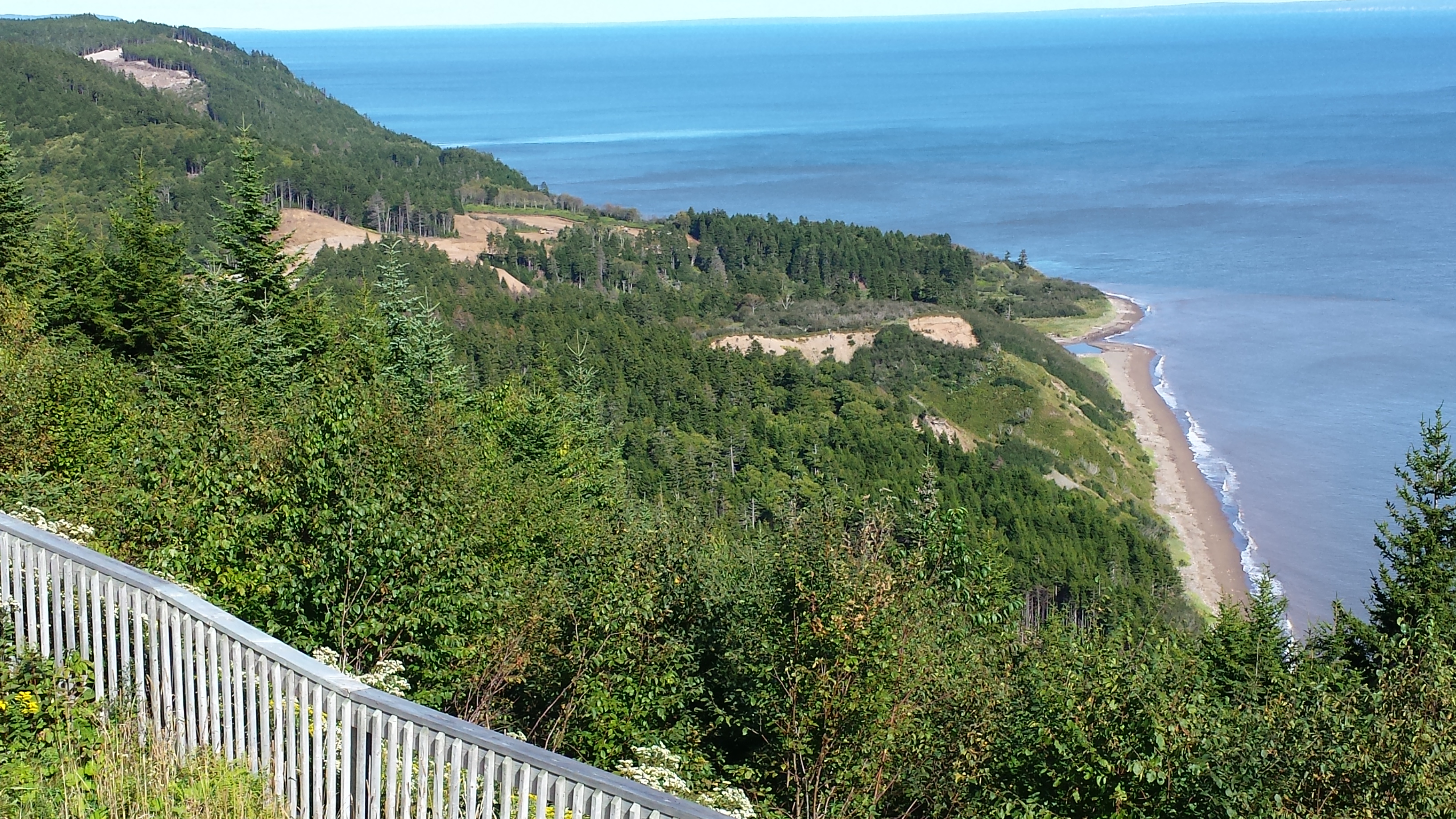
This is a view from the end of Phase I to the clearing and construction of Phase II of the Fundy Trail Parkway. Eventually, it will extend from St Martin’s all the way to Fundy National Park. The land in between is currently wilderness. Yeah, that’s different from Acadia, too…
St. Martins is a Stonehammer Geoparc site.
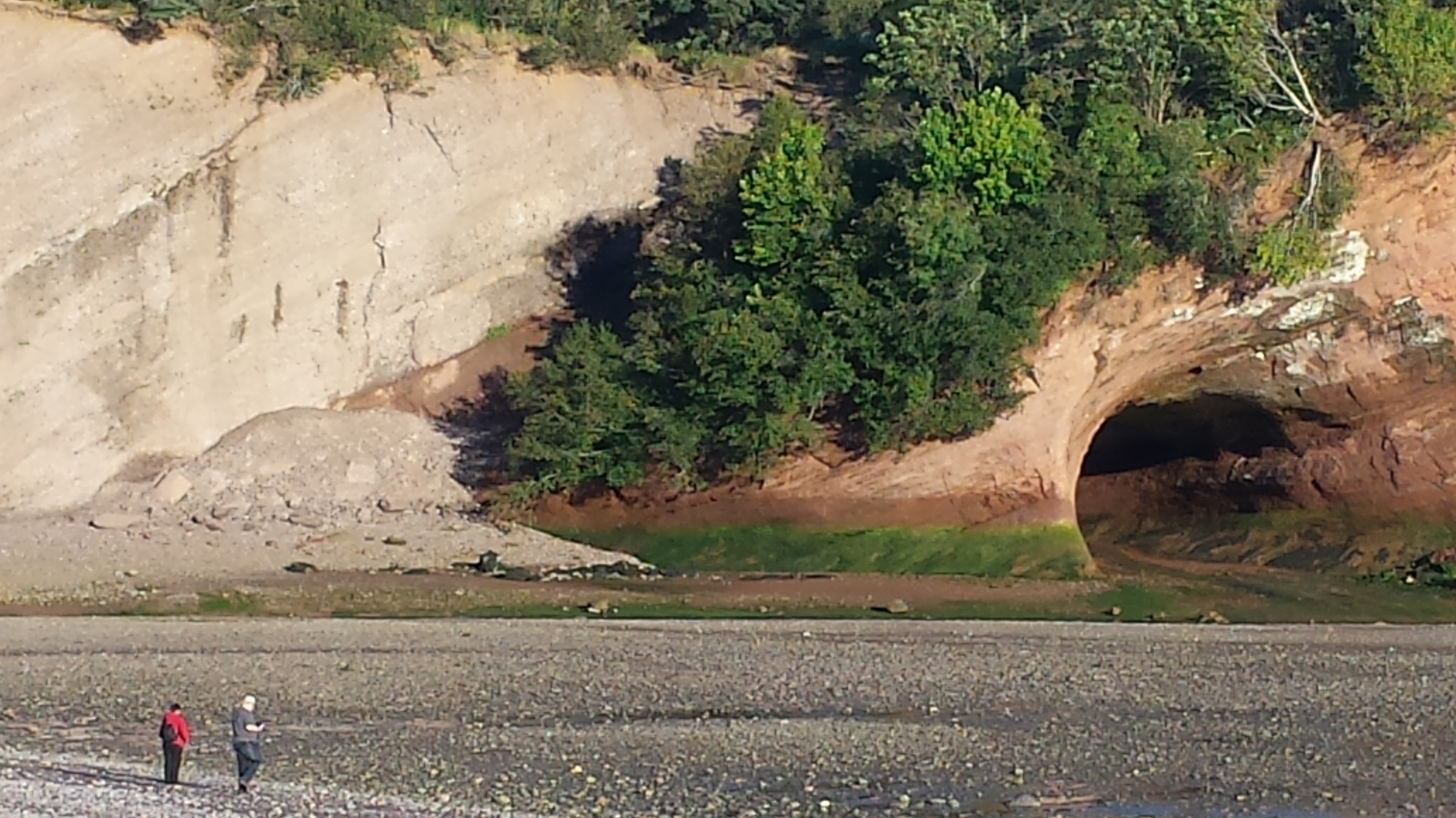
Just left of the sea caves that all tourists can see and enjoy is an important “contact” of two different geologic formations — the light colored Quaco, and the red Honeycomb Point formation. The shrubs and foliage growing along the diagonal contact disguise it during warm months…
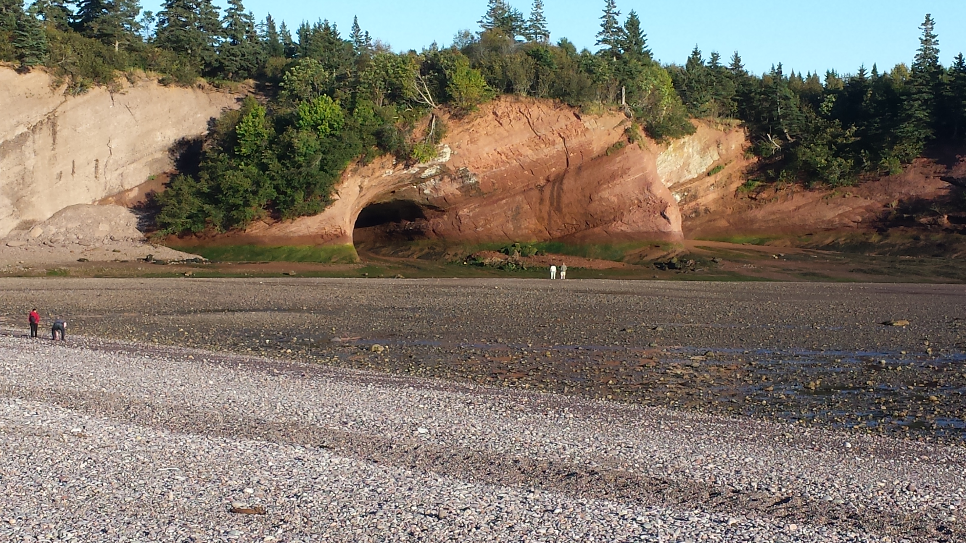
Sea caves and formation contact at St. Martin’s, low tide.
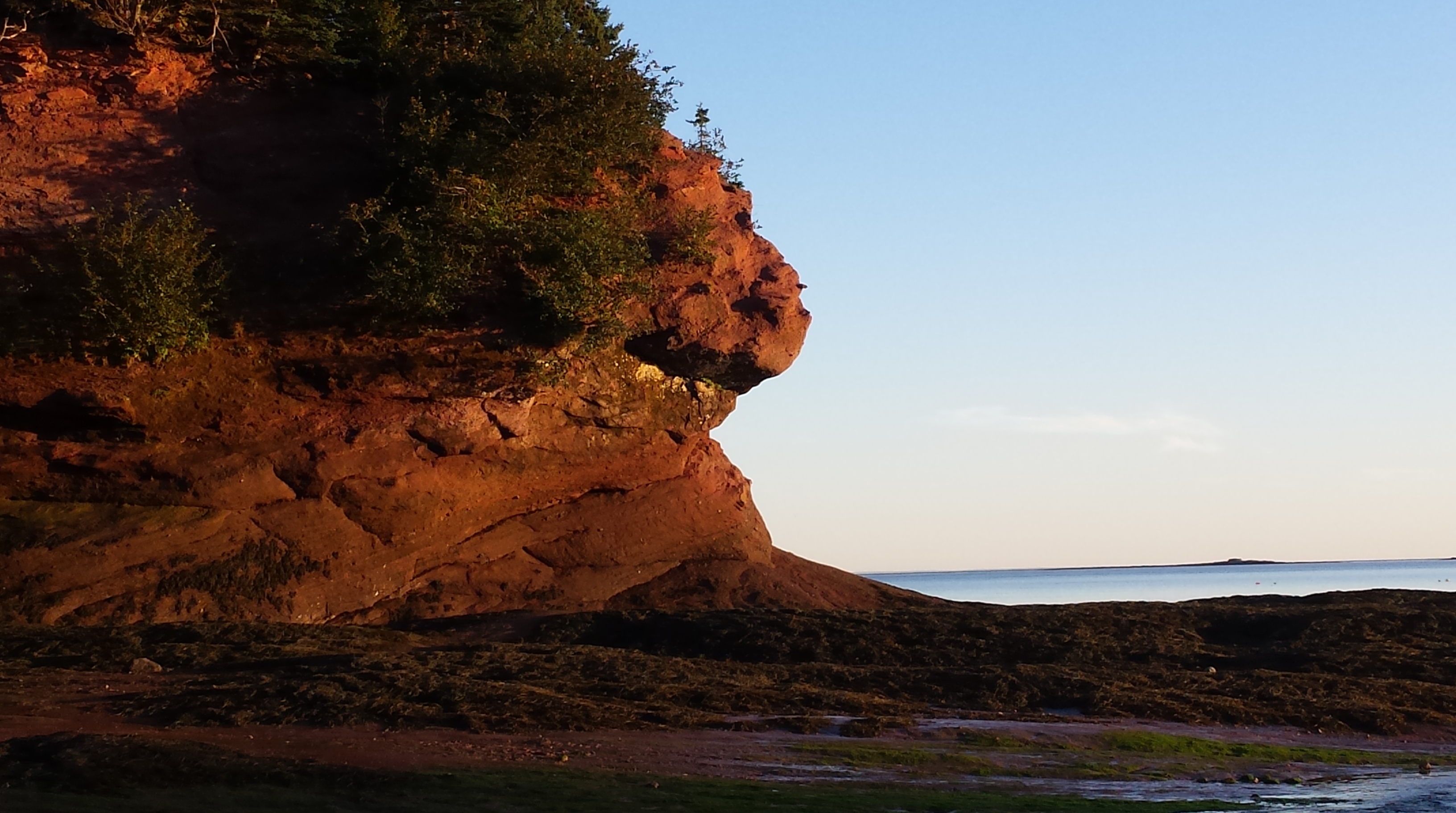
“The Sphinx” at the St Martin sea caves formation
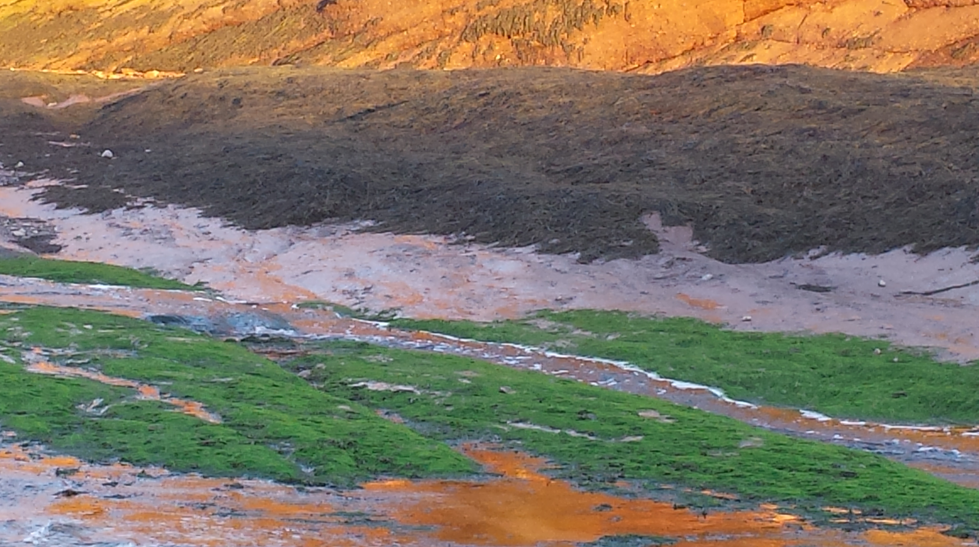
Nope, not a painting by someone from the St. Martins artist colony – just a mossy freshwater stream flowing from a spring near the sea cave passing beside the brown-green seaweed deposited when the tide covers this area. The red-orange above is the Honeycomb Point Formation sandstone. A really lovely sunset scene, but only visible at low tide, when the stream is not inundated by the sea.
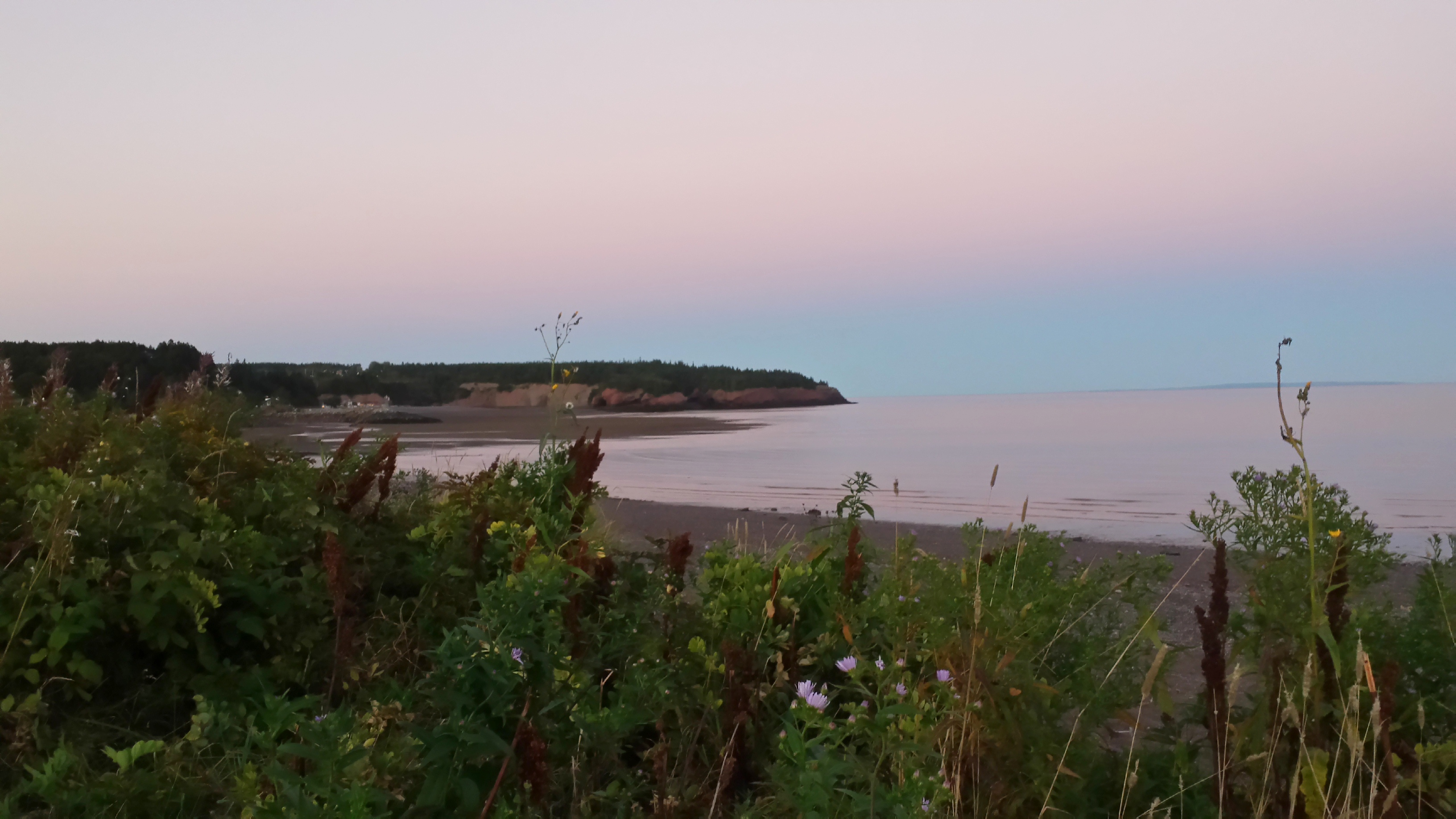
Sunset view from our campsite. Still low tide.

Sunrise the next morning.
We are inspired to keep moving farther up the Bay. Next stop Fundy National Park.
